Overview
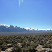
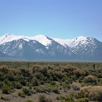
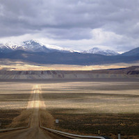
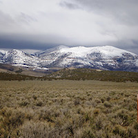
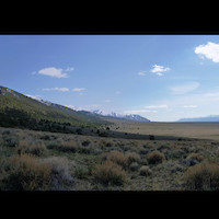
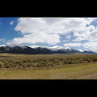
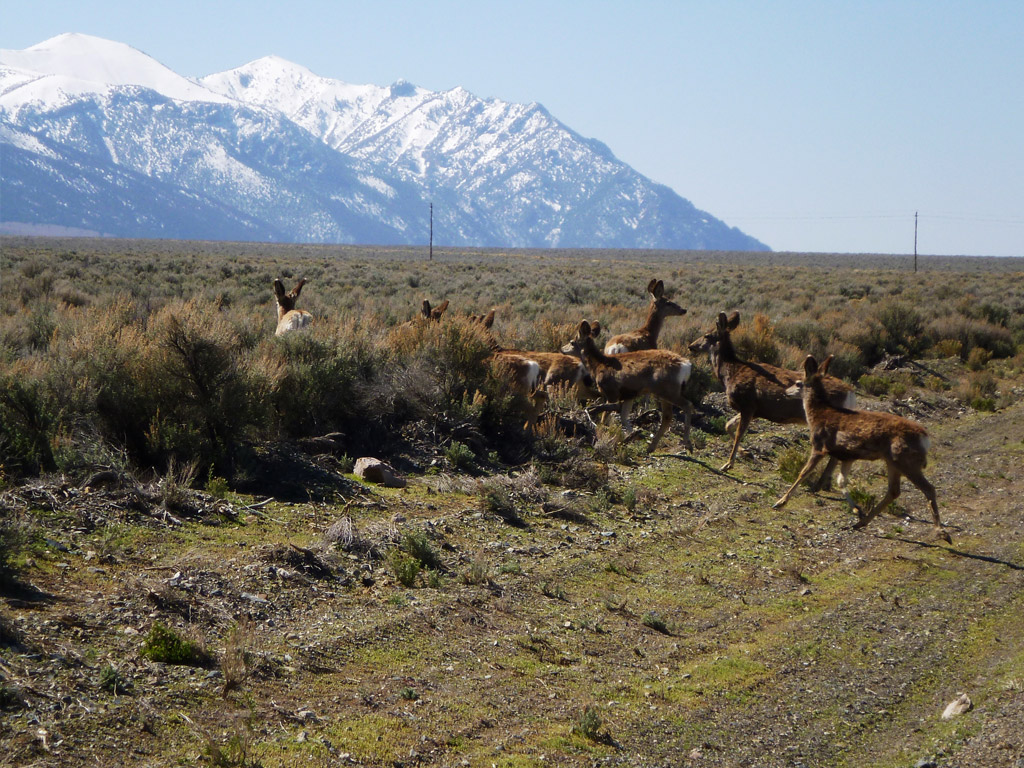
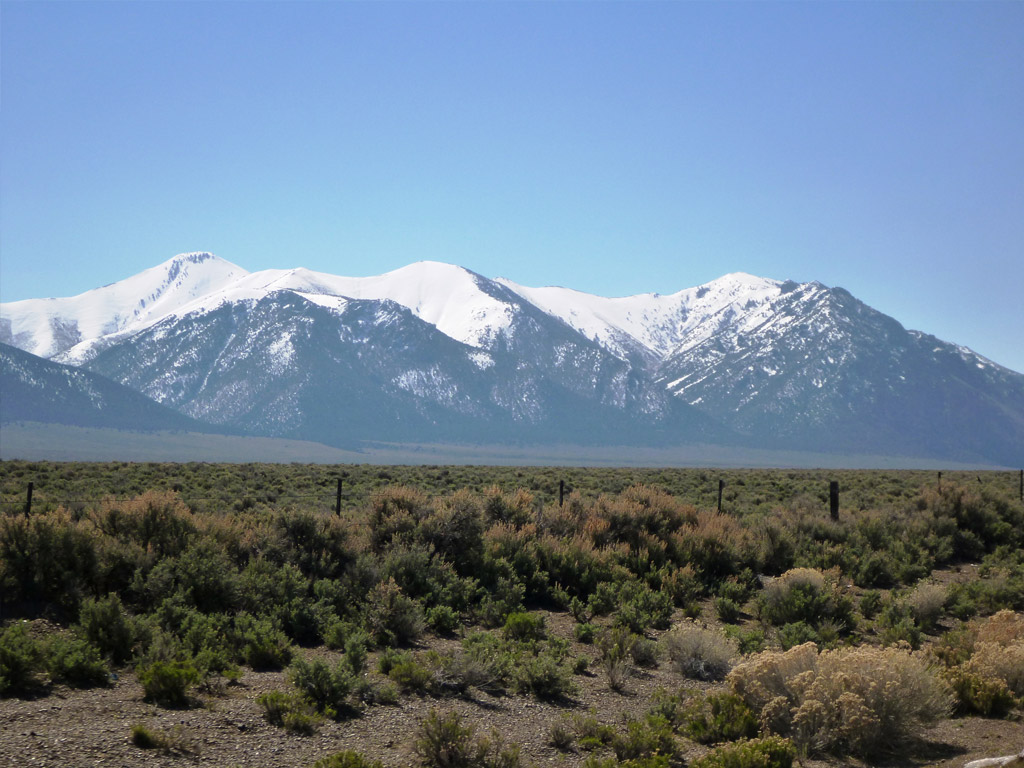
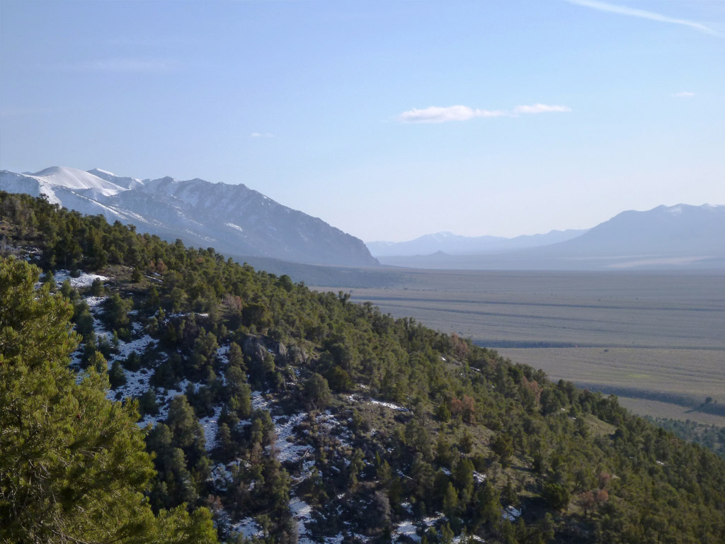
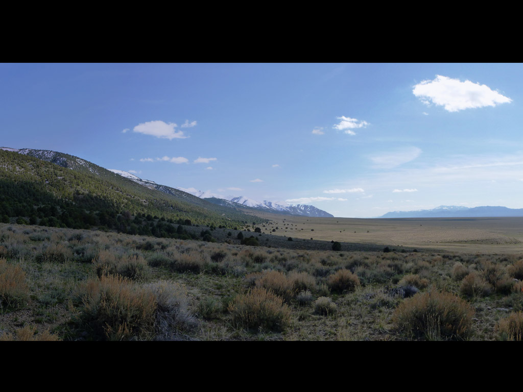
The Golden Brew project (“Golden Brew”), located 20 miles south of Austin, Nevada (Figure 1), is an early-stage exploration project prospective for Carlin-style gold mineralization that comprises 153 claims totaling an area of approximately 1,166 hectares. Regulus Resources has an option to earn into a 50% interest in the Golden Brew project from Highway 50 Gold Corp (TSX-V: HWY). Golden Brew is located at the intersection of the southern flank of the Eastgate volcanic trough and the Western Nevada rift in northcentral Nevada (Figure 2). Gold mineralization at Golden Brew is hosted within jasperoid and silicified breccias over a strike length of 2,500 feet and widths up to 200 feet that are hosted within favourable “lower-plate”, thin-bedded, platy Cambrian-aged carbonates exposed on the western slope of the Toiyabe Mountain Range. The jasperoid and silicified breccias are anomalous in all Carlin-type gold deposit pathfinder elements (e.g., As, Sb, etc.), with gold grades ranging from anomalous to 4 grams/tonne. The priority target on the property is the edges of a structural horst block located one mile west of the jasperoid outcrop, under shallow to moderate thicknesses of pediment gravel cover.


Figure 1: Regional Nevada Location Map Figure 2: Golden Brew Location Map
Golden Brew Option Agreement
Pursuant to the Golden Brew Option Agreement, Regulus can earn a 50% interest in the Golden Brew project by spending US$5,000,000 on exploration expenditures over 5 years, and assuming the underlying third-party lease payments and claim holding costs. Regulus has fulfilled the first commitment of US $500,000 of exploration expenditures. Upon earn-in, the parties will form a joint venture on a 50/50 basis.
Golden Brew NI 43-101 Technical Report
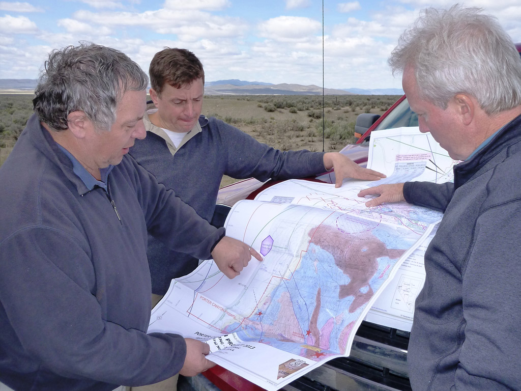
The project is described in a NI 43-101 Technical Report entitled “Technical Report: Golden Brew and Porter Canyon Properties, Lander County, Nevada” prepared for Highway 50 Gold Corp. by B. J. Price Geological Consultants Inc. dated February 13, 2013. Click to view
2013 Golden Brew - Technical Report
Location
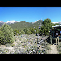
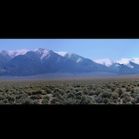
The Golden Brew project is situated along the western front of the Toiyabe Range, 20 miles south-southwest of Austin, near the southern boundary of Lander County, Nevada. The project area lies between 7,000 and 8,500 feet above sea level. Access from Austin is west along I-50 to old I-50 (Route 2). Eight miles south from Austin, turn left and proceed 11 miles southward (to the Reese River) along Route 21, an improved gravel road (Figure 2). Unimproved dirt roads traverse the remaining 7 miles eastward to the property.
Geology and Mineralization
Regional Geology
The geology of the Golden Brew project is like many of the sediment-hosted gold deposits in Nevada. Soon after deposition of the Paleozoic sediments, western (Upper Plate) siliceous sediments were thrust-faulted eastward over eastern (Lower Plate) carbonate sediments along the Roberts Mountains thrust fault during the Antler orogeny.
The Antler orogeny was followed by the Sonoma (Permian-Triassic), Sevier (early Cretaceous), and Laramide (late Cretaceous) orogeny’s, all of which affected the area. Northwest-trending folds and faults apparently formed during or slightly before the Sonoma orogeny. Broad north-northeast directed folding and intrusion of the Birch Creek and Austin plutons occurred during the Sevier and Laramide orogeny’s. Erosion accompanied all three periods of compressional orogeny and during the Sevier orogeny, lower plate rocks started to be exposed, initiating the development of the erosional windows in which the mineral deposits are generally found.
High-angle north- to northeast-trending normal faults, resulting from the onset of Basin and Range extension in early Tertiary time, appear to have channeled later gold bearing solutions, leading to the formation of the various gold and base-metal deposits Sediments underlying the property range from Cambrian to Devonian in age. Quaternary alluvium is also present in many drainages and is deeper in the pediment areas. Because of the complex folding and faulting of the Antler orogeny, only the Cambrian units remain essentially intact.
The Golden Brew project along with other nearby Carlin-type deposits and projects sit apart from the gold deposits of the traditional Carlin & Cortez Trends, and may represent a third, relatively unexplored northwest-trending boundary related to the western edge of the buried Precambrian continent in west-central Nevada. Deep-seated density contrasts reflect persistent crustal fault zones as indicated by magnetic anomalies including the Northern Nevada Rift [NNR] and Western Nevada Rift [WNR]. Fault-bounded volcano-tectonic centers, the Caetano and Eastgate Troughs of Mid-Cenozoic age, are testament to a complex geological history as recently as 18 million years ago (first described by Burke & McKee, USGS, 1979). These rifts and associated cross-structures are thought to be important deep structural zones that acted as pathways for mineral rich hydrothermal fluids that deposited the gold mineralization.
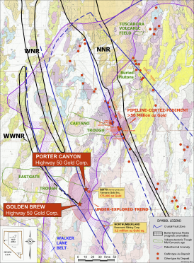
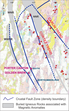
Figure 3: Regional Structural Architecture Figure 4: Location of the Western Nevada Rift [WNR]
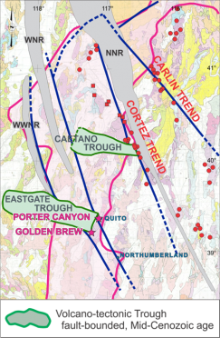
Figure 5:
Location of the Mid-Cenozoic aged Volcanic Troughs
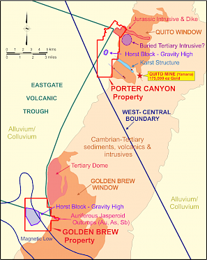
Figure 6:
Golden Brew Property Location Relative to Important Geological and Geophysical Features
Local Geology
The Golden Brew project area as described by Kirwin (1989) is dominantly underlain by thin bedded limestones which belong to the Cambrian Crane Canyon Sequence (Stewart, McKee and Stager, 1977). The Crane Canyon Sequence in the project area is thought to lie below the Roberts Mountains Thrust and above the Eastside Thrust.
Stratigraphy
The Crane Canyon Sequence consists of a package of limestone and shale, which must be several thousand feet thick and occurs in the central Toiyabe Range. Regionally, the unit consists of laminated to very thin-bedded, grey, platy-limestones and subordinate shale or slate. Locally, the sequence contains laminated and silty limestone, calcareous or siliceous shale and siltstone, and rarely contains chert (Stewart, McKee and Stager, 1977).
In the Golden Brew project area, the Crane Canyon Sequence consists mainly of thin bedded, finely crystallized, medium grey limestones which are thinly interbedded with very thin shale beds (the “Shaly limestone” member). Very few small, black chert lenses have been noted in the shaly limestones. The subordinate “Laminated limestone” member contains thin bedded, laminated, silty, medium to dark grey limestones. Calcareous shales (the “Limey shale” member) have been mapped over small areas.
In the northern portion of the (1988) Golden Brew claim block, at least 1,000 stratigraphic feet of dark grey, platy, strongly foliated, locally pyritic slate, phyllite, and lesser shale is exposed. Some phyllite appears to have undergone greenschist facies metamorphism, possibly genetically related to the large felsic intrusive body situated immediately north of the claim block. The low-grade metamorphic rocks are anomalous within the Crane Canyon Sequence, and more closely resemble regional descriptions of the Cambro-Ordovician Broad Canyon Sequence (Stewart, McKee and Stager, 1977).
Intrusions
A small portion of a Tertiary-aged stock is exposed in the northern part of the Golden Brew claim block. Where exposed on the claim block, the intrusive unit is porphyritic, and granitic to granodioritic in composition. The intrusive, which weathers red, appears to contain smaller stocks and dikes of intermediate to felsic composition.
Structure
Sedimentary bedding attitudes which are exposed on the Golden Brew claim block indicate a large antiform underlying most of the area. North of the Foster fault, only the eastern half of the antiform is exposed. South of the “Foster” fault, both limbs are indicated. The cross sections reflect the hypothesis that the antiform has been modified by steeply dipping faults, which may be partially or wholly responsible for the antiform.
In the central Toiyabe Range, the Cambrian Crane Canyon Sequence lies above the Eastside Thrust and below the Roberts Mountains Thrust. Northeast of the Golden Brew claim block, the Crane Canyon Sequence is thrust over the Cambro-Ordovician Broad Canyon Sequence along the Eastside Thrust. In the northeast corner of the Golden Brew claim block, the contact between the Broad Canyon Sequence and the Crane Canyon Sequence is obscured. The obscured contact may be stratigraphic, or may be the Eastside Thrust, which is an important· ore controlling structure in the Kingston district. If the contact were the Eastside Thrust, then the exposed block of Broad Canyon Sequence would be up-thrown relative to the Crane Canyon limestones. However, the steeply dipping faults more likely have downthrown the Broad Canyon Sequence, and this suggests a stratigraphic contact between the formations. Regardless, the Eastside Thrust probably underlies the Crane Canyon Sequence on the Golden Brew claim block and is an exploration target.
Alteration
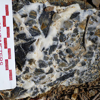
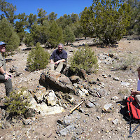
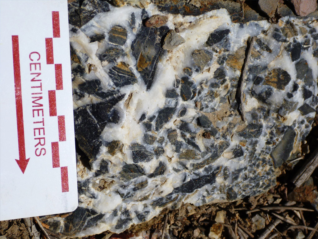
Due to the limited outcrop on the Golden Brew and Porter Canyon claim blocks, the following discussion by Kirwin (1989) of alteration is based on limited jasperoid outcrops and on trench exposures. The most prominent alteration type on the Golden Brew claim block is intense silicification. Jasperoids are present in both the Bud Zone and the Guinness zones. Outcrop exposures of jasperoid are dominantly weakly to strongly oxidized, containing disseminated and fracture-lining orange and red limonite. Where unoxidized, the jasperoids are very dark grey to black, and locally contain very finely disseminated pyrite.
The jasperoids are cryptocrystalline to finely saccharoidal in textures, and commonly contain (<1″) white quartz veins. The greatest concentrations of gold occur within strongly oxidized jasperoids which are crosscut by white quartz veins containing brecciated jasperoid fragments and some small vugs. In trench exposures, the contacts between the jasperoids and the surrounding rocks are structural. The jasperoid bounding faults generally strike N60W to N70W, and dip moderately-steeply to the southwest. Slickensides with similar orientations are common in the Bud and Guinness zones, indicating reactivation of the fluid-controlling fault. Locally, jasperoid exposures in the trenches are intensely gouged and oxidized, indicating crosscutting fault motion following silicification. The silica-rich fluids appear to have followed restricted N60W to N70W structural conduits through relatively non-permeable host rocks. Haloes of weak silicification surrounding intensely silicified zones are uncommon. The jasperoid bodies are spatially associated with narrow zones of lower-grade alteration. The less altered zones are characterized by weak to strong decalcification, weak and rarely strong argillization, bleaching, and gouging. Some of the less altered zones contain significant gold mineralization.
Drilling in 2017 intersected deeply oxidized thin-bedded silty limestones under pediment cover west of the base of the Toiyabe Range containing highly anomalous values in antimony, arsenic and gold. The zones of deep oxidation also exhibit weak to moderate decalcification.
Mineralization
The Golden Brew soil grid covers an area which contains only approximately 2% outcrop. Significant gold mineralization has been found only in jasperoid bodies and quartz veins, and the jasperoids generally are anomalous in gold. Two mineralized zones (the Bud Zone and the Guinness Zone) were identified by Meridian in 1988. The mineralized zones which lie on ridges and gullies between Porter Canyon and Brewer Canyon are enriched in gold, silver, and arsenic, and are characterized by strong silicification along faults, large calcite veins, and quartz veins. The Guinness Zone is larger than the Bud Zone and has not yet been drill tested. As much as 2.2 ppm gold has been reported from samples collected from Bud Zone jasperoids, and as much as 1.7 ppm gold has been reported from the Guinness Zone.
The Bud Zone lies topographically below the Guinness Zone (see figure X). The poorly exposed Bud Lite Zone has been shown to be an extension of the Bud Zone. The Bud Zone, which is 400 feet long and 100 feet wide, is characterized by jasperoids and quartz veins, and trends roughly N80W. Extending the Bud Zone to the Bud Lite Zone lengthens the zone to 600 feet long.
The Guinness Zone, which is 800 feet long and 150 feet wide, is characterized by large (+20 feet wide) calcite veins, with large (up to 8 feet wide) quartz veins and subordinate jasperoid outcrops. The gold mineralization is closely associated with the jasperoid bodies, although some gold is associated with the quartz veins. Small amounts of gold have been detected distal to the jasperoids in limestone outcrop rock chip samples. The overall trend of the Guinness Zone is approximately East-West.
The focus of the current exploration is for targets localized along some of these mineralized structures, but where they extend under the cover gravels to the west.
Exploration
Exploration History
1998-1999: During the latter half of 1988 and January of 1989, a program of surface exploration, evaluation and limited drilling was conducted on the Golden Brew claim block by Meridian Gold Company. The exploration program consisted of the following work:
- 1″=500′ scale mapping of the claim block
- 1″=100′ scale ‘mapping of the soil grid area.
- 338 soil samples were collected on 100-foot centers, and were analyzed for gold, silver and arsenic.
- 56 rock chip samples were collected and were analyzed for gold and silver.
- Three trenches were cut across the Bud Zone jasperoid, exposing rock along most of their lengths. A total of 850 feet of trench was constructed.
- The trenches were mapped in detail, and were channel sampled. A total of 59 continuous channel samples were collected and analyzed for gold, silver, and arsenic.
- 3,400 feet of drill roads were constructed in the Bud Zone and the Bud ‘Lite Zone.
- Eight drill holes were drilled in the Bud Zone, for a total footage of 2,885 feet (Table 1).
2010-2011: Highway 50 Gold Corp conducted extensive gravity and CSMAT geophysical surveys across the Golden Brew property, west of the range-front fault in an area of gravel cover. These surveys were designed to locate gold bearing structures within the favorable host rocks at reasonable exploration depths beneath the gravel cover. The geophysical program was successful in locating an uplifted horst block with potential gold bearing structures extending through it. In 2011, four RC-holes totaling 8,800 feet were drilled to test these targets.
The drilling in 2011 intersected a 150-foot section of elevated arsenic and antimony at the south-east corner of the horst block within the favourable carbonate section. The horst block is coincident with the projected intersection of a set of crustal scale structures and a strong magnetic low. This magnetic low may reflect magnetic destruction of alteration related to the mineralizing system. Assay results showed a 150-foot interval of anomalous arsenic (to 290 ppm) and antimony (to 24 ppm) in drill hole GB-3 (Table 2). These levels are higher than the anomalous soils peripheral to the auriferous jasperoid at the range front 7500 feet to the east.
2014: Regulus options the Golden Brew project from Highway 50 Gold Corp. and concentrates on permitting the project for drilling.
2017: Regulus completes five RC drill holes in August 2017 totaling 9,640 feet with bedrock depths varying from 680 feet to 1,530 feet.
Results
In 1988, Meridian drilled eight percussion drill holes into the Bud Zone, which is located within the exposed range to the east of the current Golden Brew claims. The following drill results were obtained by Meridian in 1988: samples were sampled every five feet, and the cuttings were analyzed for gold, silver, and arsenic. The gold geochemical data are presented in Table 1.
Table 1: 1988 Meridian Drill Results
Drill Hole | From (ft) | To (ft) | Width (ft) | Gold (opt) | Width (m) | Gold (g/t) |
GB-1 | 65 | 125 | 60 | 0.007 | 18.3 | 0.240 |
incl. | 75 | 110 | 35 | 0.01 | 10.7 | 0.343 |
GB-2 | 215 | 235 | 20 | 0.01 | 6.1 | 0.343 |
GB-3 | 0 | 60 | 60 | 0.016 | 18.3 | 0.549 |
incl. | 25 | 55 | 30 | 0.021 | 9.1 | 0.720 |
incl. | 40 | 55 | 15 | 0.025 | 4.6 | 0.857 |
GB-4 | discouraging geochemical data | |||||
GB-5 | 140 | 150 | 10 | 0.005 | 3.0 | 0.171 |
GB-6 | 0 | 30 | 30 | 0.006 | 9.1 | 0.206 |
GB-7 | Did not intercept target | |||||
GB-8 | discouraging geochemical data | |||||
In 2011, Highway 50 Gold completed a four RC drill holes totaling 7,780 feet at Golden Brew.
Table 2: 2011 Highway 50 Gold Corp Drill Results
Drill Hole | Location | Interval | Length | Description |
GB-11-1 | 0 to 2,145 ft. | 2, 145 ft. | Alluvium Volcanic tuffs | |
GB-11-2 | 6,000′ south of GB-1 | 0 to 2,060 ft. | 2,060 ft. | Alluvium Volcanic tuffs Thin-bedded limey siltstones |
GB-11-3 | 4,000′ south of GB-2 and 7,000′ WSW of the large auriferous jasperoid at Golden Brew | 0 to 1,380 ft. | 1,380 ft. | Alluvium Thin-bedded limey siltstones Carbonaceous phyllites |
GB-11-4 | 3,000′ south of GB-3 | 0 to 1,685 ft. |
In 2017, Regulus completed a five RC drill holes totalling 9,640 feet at Golden Brew. Of note, step-out drilling from drill hole GB-11-3 intersected pyritic carbonaceous gouge in drill hole GB-17-7. The bottom 20 feet in the hole assays up to 55 ppb Au, 828 ppm As, and 130ppm Sb. Highly anomalous antimony was also encountered over significant widths in GBR-17-5 and GBR-17-6 within quartz-calcite veins and limonite/hematite soaked silty limestone.
Table 3: 2017 Regulus Drill Results
Drill Hole | Location | Interval | Length | Description |
GBR-17-5 | 480707 E 4342063 N NAD 27 | 0 to 1,235 ft 1,235 to 2,000 ft | 1,235 ft 765 ft | Alluvium Thin-bedded silty limestones oxidized to TD |
GBR-17-6 | 480300 E 4342420 N NAD 27 | 0 to 1,532 ft 1,532 to 2,000 ft
| 1,532 ft 468 ft
| Alluvium Thin-bedded silty limestones oxidized to TD |
GBR-17-7 | 750 feet SW of GB-11-3 479714 E 4341193 N NAD 27 | 0 to 1,400 ft 1,400 to 2,000 ft | 1,400 ft 600 ft | Alluvium Thin-bedded silty limestones bottomed in pyritic carbonaceous gouge |
GBR-17-8 | 480757 E 4340657 N NAD 27 | 0 to 685 ft 685 to 1,440 ft | 685 ft 755 ft | Alluvium Thin-bedded silty limestones, some micritic limestones bottomed in unoxidized limey sediments |
GBR-17-9 | 500 feet SE of GB-11-3 479950 E 4341193 N NAD 27 | 0 to 1,237 ft 1,237 to 2,200 ft | 1,237 ft 963 ft | Alluvium Thin bedded limey siltstones oxidized to TD |
Recent Exploration Program at Golden Brew
Regulus completed a five-hole reverse circulation drill program in 2017, for a total of 2,939 metres. The drill program tested a Carlin type arsenic-antimony-gold system located within an uplifted horst block on the western edge of a shallowly buried Lower-plate Window. The area of interest is outboard of a large zone of auriferous (to 4 g/t gold) jasperoid exposed on the lower slopes of the Toiyabe Mountain Range.
Bedrock was intersected in all holes beneath 207 to 466 metres (680 to 1,530 feet) of post mineral valley fill. Drilling was widely spaced, targeting zones of structural complication, gravity lows, and magnetic lows as indicated by geophysical surveys. All the drill holes intersected deeply oxidized sections of thin bedded silty limestone with oxidation consisting of pervasive limonite/hematite staining and accompanied by local weak to moderate decalcification. Locally, this alteration has highly elevated values in arsenic (to 828 ppm) and antimony (to 812 ppm) with anomalous gold (to 67 ppb). Of note, drill hole GBR-17-07 in the southwest corner of the area drilled, intersected a zone of pyritic carbonaceous gouge from 1,980 feet to 2,000 feet, which has highly anomalous arsenic (to 829 ppm), antimony (to 130 ppm), and elevated gold (to 55 ppb). This hole bottomed in mineralization.
Strategy Going Forward
Based on the drilling to date, the Regulus intends to undertake follow-up drilling in the area.